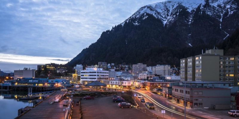

The City and Borough of Juneau, commonly known as Juneau, is the capital city of Alaska. Located on the Gastineau Channel and situated on the Alaskan Panhandle, it is the second largest city in the U.S. by area.
Juneau is unique among U.S. capitals in that there are no roads connecting the city to the rest of the state. The absence of a road network is due to the extremely rugged terrain surrounding the city. This in turn makes Juneau a de facto island city in terms of transportation, since all goods coming in and out must go by plane or boat, in spite of the city’s being on the Alaskan mainland.
As the 2nd largest capital city by area, Juneau has distinct pockets of population and is very spread out. Downtown Juneau sits at sea level and is nestled at the base of Mount Juneau, with peaks reaching 3,500 – 4,000 feet high, and across the Gastineau Channel from Douglas Island. The downtown area of Juneau is located approximately 10 miles from the airport and 14 miles from the Alaska Marine Highway Ferry Terminal located in Auke Bay.
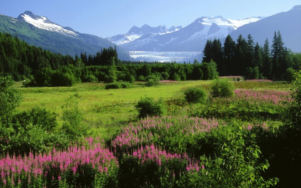
The Mendenhall Valley, or the Valley as it is called by locals, is the drainage area of the Mendenhall River. The valley contains a series of neighborhoods and comprises the largest pocket of population within the corporate limits of the City and Borough of Juneau. The valley was formed by Mendenhall Glacier over the course of roughly three thousand years and was named after Thomas Corwin Mendenhall. The Mendenhall Valley begins ten miles from the downtown area and is the location of the Juneau International Airport. The valley ends ten miles farther west at Auke Bay.
Other small pockets of populace located within the borough include the tiny towns of Douglas, located on Douglas Island and Auke Bay, located north of the Mendenhall Valley. The Lemon Creek area, located at the base of the Lemon Creek Glacier, is halfway between the downtown area and the Valley.
Getting Around
I explain the above because you should know, prior to traveling to Juneau, that unless you plan to remain in, and only in, one of those five pockets described above, you are either going to 1). need to rent a car, 2). get comfortable with public transportation, 3). resign yourself to paying for taxis or Ubers or 4). All of the above.
Juneau is not a difficult or confusing city to get around, since the road system is very limited. There is one major “highway” (if you could call it that … locals call it “The Road”), but there is no metro or subway and it is VERY spread out. For instance, you may want the action of downtown where there are too many restaurants, food trucks, stores and bars to count (I am slowly but surely making my around to as many of these establishments as I can. You can check out my posts on either the Food & Drink, Explore or Hiking pages located under the Visit tab above). But at some point you WILL want to visit the Mendenhall Glacier. The public bus does NOT stop at the glacier and instead drops you on the outskirts of the Tongass National Forest where you would then walk the two miles along the very nice bike path in order to check it out. Just remember that you’ll also have to walk the two miles back to the bus stop in order to catch it.
This is just one example. Exploring anything past Auke Bay will require access to a vehicle, be it rental car or taxi/Uber. There are plenty of things to see “out the road” including but not limited to the Shrine of St. Therese, the Jensen-Olsen Arboretum and the actual “end” of the road.